My first mistake this morning was to choose to walk from Picton Marina to Waikawa Marina – supposedly a 50 minute walk, each way.
The walk was mostly flat, which was a good thing, but it was pretty boring, taking me past people’s backyards and local playing fields. Nothing like my walk to Bob’s Bay yesterday. I’d read that the walk was around 3.5km in length and I was confident I could manage that. It’s funny once I have a target in mind I can continue in confidence, not getting anxious about when I will get there. But it was longer than that. Not much, but enough for me to start to wonder about the information about the other walking tracks.
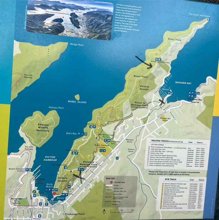
In fact, the walking trails around here have very little detail and the sign posts can be even more confusing.
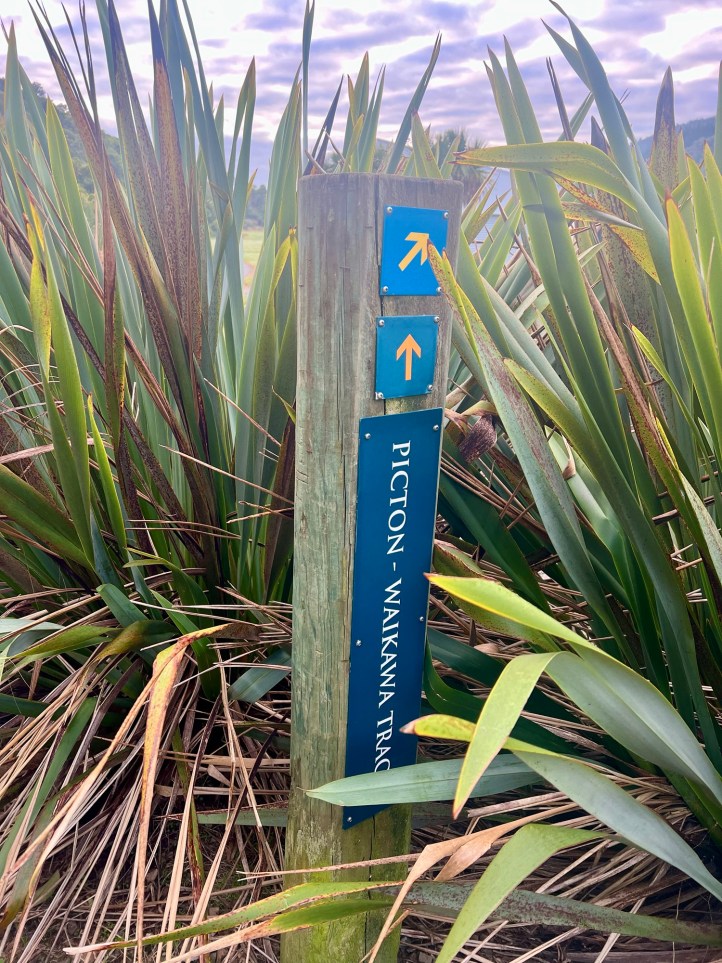
Both are correct actually, but I’d like to know how long each option is. Then I could make an informed choice.
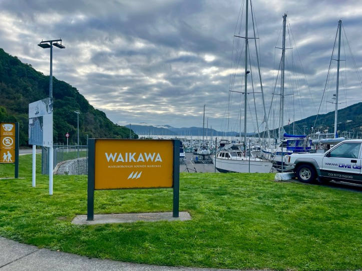
When I arrived at the end of the track I was still around 500m away from the Waikawa Marina.
I was hoping for some public toilets, like the very fancy ones at the Picton Marina.
Why fancy? Well, once you’re inside the self-contained cubicle and pushed the button to lock yourself in an announcement comes over a speaker alerting you to a 10 minute time limit, and then some very peaceful music is played while you’re in there. I didn’t wait longer than 10 minutes to find out what would happen if I extended my stay.
Anyway, there was none at Waikawa Marina, and when I asked Google where the closest public toilets were I panicked as it indicated they were a 20 minute walk in a direction away from the track. So, I chose to turn around and head back towards Picton.
I had spotted a sign about a kilometre before I arrived at the Waikawa Marina pointing to the Snout Track. I had been very tempted to take it, but decided to stick to my plan and complete the Marina to Marina walk.
However on the way back I decided to risk it and take to the hills and a much prettier walk.

I saw a few more signs with arrows pointing towards the Snout. I wasn’t planning to walk the full way but I was confident I would be able to link back up to the track I was on yesterday, and hence be able to get back for morning tea with Mick as planned.
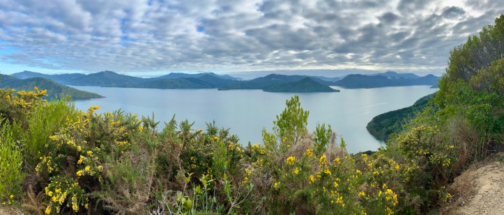
I came across the very first sign (actually pointing to Queen Charlotte View) that indicated a distance in time – 30 minutes. And, there were public toilets. By now I had been walking for almost 2 hours and thought that I could manage that. I have marked the first photo of the map with a large arrow to show where I made it to on my return.
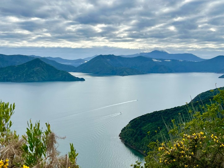
The views were wonderful.
I was only 15 minutes into the 30 minutes when I calculated that I would get back much later than I had told Mick and I knew he’d be worried. So I made the decision to turn around and head back towards Picton.

Mick was waiting for me at the Marina when I returned, a little later than planned, but pleased to see I’d made it back safely. There were many more people walking the tracks today – even though the weather was not as perfect as yesterday.
We actually had a quiet afternoon – but that is ok. When you’re on holidays, every day does not need to be action packed. We both enjoyed reading our books and planning some future travel ideas.
Mick bought himself some Bluff Oysters for an entree for dinner this evening – and he loved them.
This was our last day in Picton.

We will catch a bus tomorrow to our next destination where we will get a bit more serious about our wine tasting on the South Island.

You did yourself proud Jane! Hope you got your money’s worth. I’m sure you would have. I now know that Bluff oysters come from Bluff. Not that much progress in the cause of civilisation, but still.
Lovely photos! It seems those views would have made the extra walking time well worth it.